


MIDDLETOWN CITY MIDD5WD4 Voting District, Butler County, Ohio
About
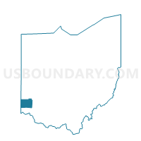
Outline

Summary
| Unique Area Identifier | 643136 |
| Name | MIDDLETOWN CITY MIDD5WD4 Voting District |
| County | Butler County |
| State | Ohio |
| Area (square miles) | 0.57 |
| Land Area (square miles) | 0.57 |
| Water Area (square miles) | 0.00 |
| % of Land Area | 100.00 |
| % of Water Area | 0.00 |
| Latitude of the Internal Point | 39.49366410 |
| Longtitude of the Internal Point | -84.34518940 |
Maps


Graphs
Select a template below for downloading or customizing gragh for MIDDLETOWN CITY MIDD5WD4 Voting District, Butler County, Ohio


Neighbors
Neighoring Voting District (by Name) Neighboring Voting District on the Map
- 0089 FRA-T-W Voting District, Warren County, OH
- 0108 TC-T-SWA Voting District, Warren County, OH
- MIDDLETOWN CITY MIDD11WD3 Voting District, Butler County, OH
- MIDDLETOWN CITY MIDD1WD4 Voting District, Butler County, OH
- MIDDLETOWN CITY MIDD3WD4 Voting District, Butler County, OH
- MIDDLETOWN CITY MIDD7WD4 Voting District, Butler County, OH
- MIDDLETOWN CITY MIDD8WD4 Voting District, Butler County, OH
Top 10 Neighboring County Subdivision (by Population) Neighboring County Subdivision on the Map
- Middletown city, Butler County, OH (45,994)
- Franklin township, Warren County, OH (30,312)
- Turtlecreek township, Warren County, OH (15,143)
Top 10 Neighboring Place (by Population) Neighboring Place on the Map
Top 10 Neighboring Unified School District (by Population) Neighboring Unified School District on the Map
Top 10 Neighboring State Legislative District Lower Chamber (by Population) Neighboring State Legislative District Lower Chamber on the Map
- State House District 67, OH (143,439)
- State House District 55, OH (135,473)
- State House District 53, OH (118,174)
Top 10 Neighboring State Legislative District Upper Chamber (by Population) Neighboring State Legislative District Upper Chamber on the Map
Top 10 Neighboring 111th Congressional District (by Population) Neighboring 111th Congressional District on the Map
Top 10 Neighboring Census Tract (by Population) Neighboring Census Tract on the Map
- Census Tract 316, Warren County, OH (7,791)
- Census Tract 307, Warren County, OH (6,371)
- Census Tract 136, Butler County, OH (5,064)
- Census Tract 125, Butler County, OH (4,812)
- Census Tract 141, Butler County, OH (2,276)